Azerbaijan sits at the meeting point of Europe and Asia, wedged between the Caspian Sea, the Caucasus Mountains, and its neighbors Russia, Georgia, Armenia, Iran, and Turkey. For anyone planning a trip, researching a school project, or simply trying to understand where a particular city or region fits into the bigger picture, having the right map on hand makes a real difference.This guide brings together a full collection of official Azerbaijan maps, covering major cities, regional guides, and historically significant areas.
Every map here is downloadable as a PDF, so you can view exact locations, get a clear overview of towns and attractions, and plan your route with confidence, whether you’re heading to the bazaars of Baku or the mountain roads of Gabala.Below, you’ll find city maps, regional guides, and a couple of unique cultural maps that tell a bigger story about Azerbaijan’s heritage and history.
Publications
Azerbaijan’s official tourism publications go beyond simple maps. They combine cartographic detail with short write ups on local history, culture, and things worth seeing on the ground. Each publication in this collection is designed to work as a standalone travel companion, whether you’re printing it out before a trip or checking it on your phone while walking through a new city.
These publications are updated periodically to reflect new attractions, restored heritage sites, and changes to the country’s regional boundaries, so it’s worth checking back if you downloaded a version some time ago.
Regional Maps
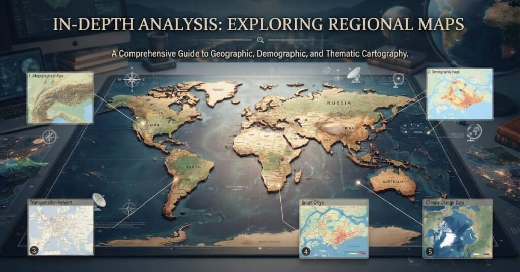
Azerbaijan is officially divided into economic regions and dozens of administrative districts, but for travelers, it helps to think in simpler terms: a capital city, a handful of major regional hubs, and several distinct travel zones (north, south, and west). The regional maps section below breaks the country down into exactly that kind of practical, easy to follow structure.
Each map listed here focuses on a specific city or area and includes points of interest, road layouts, and, in several cases, a short description of what makes that destination worth visiting.
Shaki City Map
Shaki, in northwestern Azerbaijan, is often described as one of the country’s most charming towns. Its cobbled streets, caravanserais, and traditional houses give it the feel of a small European city with distinctly oriental touches. The historic center, including the Khan’s Palace, was added to the UNESCO World Heritage List in 2019 thanks to its unique architecture and its role as a trading post along the Silk Road.
The Shaki city map lays out the old town, the palace complex, and the main roads connecting Shaki to the rest of the Shaki-Zagatala region. It’s a useful reference for anyone planning a walking tour or trying to locate specific caravanserais and craft workshops before arriving.
Why download it: It helps you plan a walking route through the historic center without missing key landmarks like the Palace of Shaki Khans.
Ganja City Map
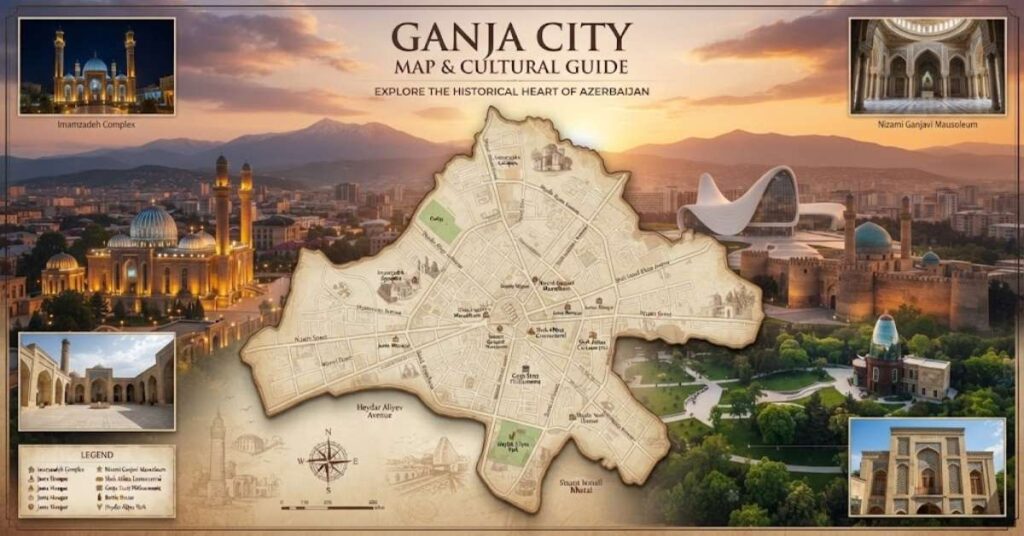
Ganja is Azerbaijan’s third largest city and one of its oldest, with roots going back over a thousand years. Known historically as a center of poetry and craftsmanship (it’s the birthplace of the poet Nizami Ganjavi), Ganja today mixes Soviet era architecture with restored historical monuments, parks, and mosques.
The Ganja city map covers the city center, major squares, and the layout of neighborhoods, making it easier to navigate between sites like the Juma Mosque, Bottle House, and Nizami Mausoleum.
Why download it: Ganja’s street layout can be confusing for first time visitors, and this map clears up how the historic core connects to newer districts.
Mingachevir City Map
Mingachevir sits on the banks of the Kura River and is best known for the Mingachevir Reservoir and hydroelectric station, the largest of its kind in the South Caucasus. The city has a more industrial, planned feel compared to Azerbaijan’s older towns, but it also serves as a convenient base for visiting the surrounding lakes and forests.
This map outlines the city grid, the reservoir shoreline, and access routes for those traveling onward to nearby regions like Yevlakh or Shaki.
Why download it: If you’re combining a Mingachevir stop with a wider northern route trip, the map shows exactly how the city connects to nearby highways.
Lankaran City Map & Lankaran-Astara Regional Map
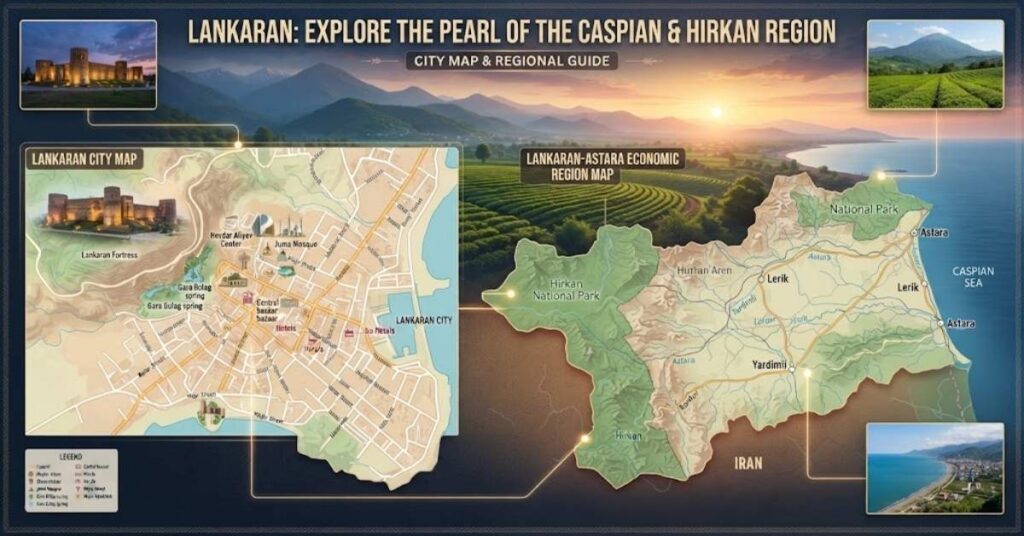
Lankaran is the main hub of Azerbaijan’s southern region, sitting on the Caspian coastline and close to the Talish Mountains. The area is known for a subtropical climate, tea plantations, citrus orchards, and Hirkan National Park, one of the last remnants of ancient Hyrcanian forest in the world.
This combined map covers both the city of Lankaran itself and the wider Lankaran-Astara corridor, which stretches south toward the Iranian border. It’s particularly helpful for travelers planning to explore beyond the city center into the Talish foothills.
Why download it: It’s one of the few maps that covers both a city and its surrounding regional corridor in a single reference, useful for multi-stop southern itineraries.
Baku Visitor Map
Baku, Azerbaijan’s capital, is where most international visitors begin their trip. Described as an eastern city with a distinctly western outlook, Baku blends the medieval Old City (Icherisheher) with modern landmarks like the Flame Towers and Heydar Aliyev Center.
The Baku visitor map is one of the most detailed in this collection, covering the Old City walls, the Boulevard along the Caspian seafront, main museums, shopping areas, and transport links. It’s also available in multiple languages, including English and Russian.
Why download it: With so much packed into a compact city center, this map helps first time visitors avoid backtracking and plan a logical sightseeing route in one day or across several.
Polish Legacy Map in Baku and Beyond
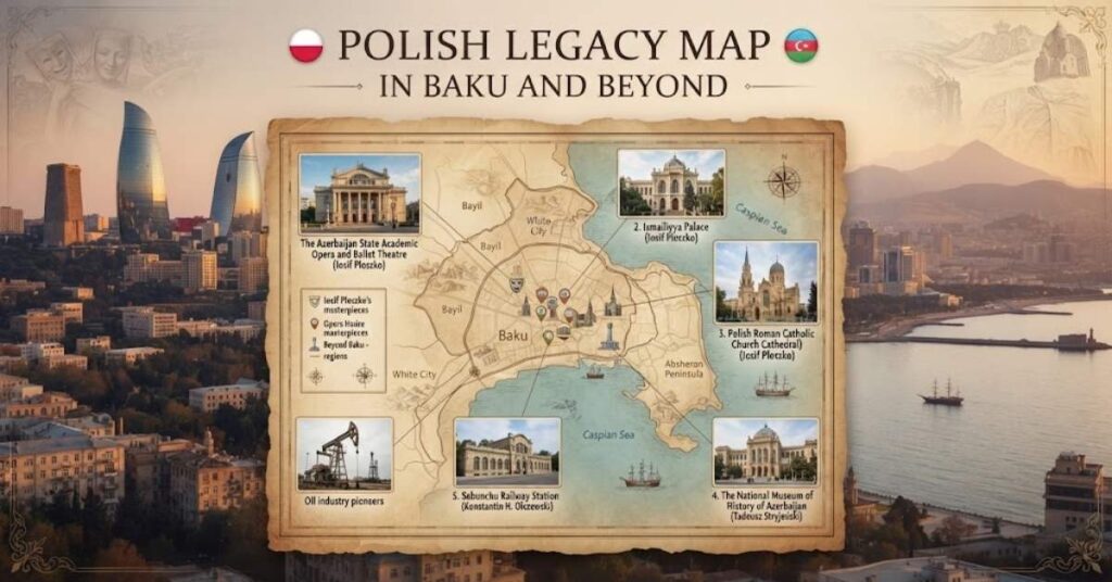
This is one of the more unusual maps in the collection, and one that’s easy to overlook. During Azerbaijan’s oil boom in the late 19th and early 20th centuries, Baku attracted architects, engineers, and professionals from across Europe, including a notable number from Poland. Three consecutive chief architects of Baku during this period (Jozef Goslawski, Kazimierz Skorewicz, and Jozef Ploszko) were of Polish origin, along with the architect Eugeniusz Skibinski.
Their influence shaped many of Baku’s most recognizable buildings, blending European classical styles with local and eastern architectural elements. The Polish legacy extended beyond the capital too. Architect Ignacy Krzysztalowicz served as chief architect of Ganja (then Yelizavetpol), while Catholic churches built by exiled Polish soldiers still stand in Gusar and Zagatala.
This map, developed jointly by the Polish Embassy in Baku and Azerbaijan’s tourism authorities, traces a walking route past these buildings, including the grave of Polish engineer Pawel Potocki and the house museum of cellists Leopold and Mscislaw Rostropowicz.
Why download it: It’s a genuinely niche cultural trail that most general guidebooks skip entirely, ideal for travelers interested in architecture and lesser known history.
South Region Guide Map
Azerbaijan’s south region stretches from the lowlands near Lankaran up into the Talish Mountains, bordering Iran. It’s one of the greenest and most biodiverse parts of the country, home to tea gardens, national parks, and coastal wetlands that attract migratory birds.
This regional guide map covers the broader south, tying together towns, protected areas, and road connections that a single city map wouldn’t capture.
Why download it: It gives a wider planning view for travelers who want to string together several southern destinations rather than visiting just one city.
West Region Guide Map
The west region of Azerbaijan centers around Ganja and stretches toward Goygol and the foothills of the Lesser Caucasus. This part of the country is known for lakes, forested reserves, and a milder climate than the Absheron Peninsula.
The west region guide map shows how cities like Ganja, Goygol, and Shamkir connect, along with nearby natural attractions such as Goygol National Park.
Why download it: Useful for road trip planning across the western economic region, especially if you’re combining city visits with nature stops.
North Region Guide Map
Azerbaijan’s north region runs along the Greater Caucasus range and includes some of the country’s most popular mountain destinations, including Guba, Gabala, and Gakh. Expect alpine scenery, waterfalls, and villages known for crafts like carpet weaving and copperware.
This guide map lays out the region’s main towns and the mountain roads linking them, which is especially helpful given how winding and less signposted these routes can be.
Why download it: Mountain roads in the north region aren’t always intuitive, and this map helps you sequence a multi-town itinerary efficiently.
Guba City Map
Guba (also spelled Quba) is often called the gateway to the Caucasus Mountains. It’s known for stunning natural scenery, historic mosques, and a strong tradition of carpet weaving. The nearby village of Krasnaya Sloboda is also notable as one of the largest all Jewish settlements outside Israel.
The Guba city map covers the town center along with routes leading toward mountain villages like Khinalig, one of the highest and most isolated settlements in the Caucasus.
Why download it: It helps travelers plan the popular Guba to Khinalig mountain route, a common day trip from the city.
Gabala City Map
Gabala, once the capital of ancient Caucasian Albania, is now one of Azerbaijan’s most visited tourism hubs thanks to its mix of historical sites and modern attractions like the Tufandag mountain resort and cable cars.
This map covers the city and its immediate surroundings, including archaeological sites, resort areas, and access roads to nearby waterfalls and lakes.
Why download it: With so many activities spread across a wide area, the map helps visitors decide what’s realistically reachable in a day.
Goygol City Map
Named after the striking turquoise Lake Goygol, this town and its surrounding national park are among Azerbaijan’s most photographed natural landscapes. The lake itself formed after a major earthquake in the 14th century, and the area is popular for hiking and short nature retreats.
The Goygol city map outlines the town layout and access points into the national park.
Why download it: It clarifies how to reach the lake and park entrances from the town center, which isn’t always obvious from general road maps.
Gakh City Map
Gakh is a quieter district in Azerbaijan’s Shaki-Zagatala region, known for dense forests, old churches, and villages that have kept much of their traditional character. It’s less visited than nearby Shaki or Gabala, which makes it appealing for travelers looking for a slower pace.
This map covers Gakh town and the rural routes branching out toward surrounding villages.
Why download it: Gakh’s rural roads are sparsely marked elsewhere, so this map fills a real gap for independent travelers.
The Peak of Victory
Shusha holds a unique place in Azerbaijan’s cultural and historical identity. Perched in the Garabagh region amid the Lesser Caucasus Mountains, it was founded in 1752 as the capital of the Garabagh Khanate and became famous as a center of poetry, music, and carpet weaving. After nearly three decades under occupation, Shusha was liberated in November 2020, and has since been declared Azerbaijan’s cultural capital, as well as Cultural Capital of the Turkic World for 2023.
This map, titled “The Peak of Victory,” documents Shusha’s key historical and cultural sites, alongside the Victory Road tourism route, a roughly 101.5 kilometer corridor connecting Fuzuli, Khojavend, and Khojaly with Shusha. It’s available in both English and Azerbaijani.
Why download it: For anyone visiting the restored Garabagh region, this map is currently one of the only detailed public references covering Shusha’s historical layout and the surrounding Victory Road route.
How to Use These Maps
- Download the PDF that matches your destination before you travel, since mobile data coverage can be patchy in mountain regions like Gakh or Lerik.
- Cross reference regional guide maps (north, south, west) with individual city maps for multi-stop trips.
- Keep a printed copy of the Baku visitor map handy if you plan to explore the Old City on foot, as GPS signal can be unreliable between the narrow stone streets.
- Check publication dates where available, since road infrastructure and attraction details are periodically updated.
Conclusion
Whether you’re mapping out a first trip to Baku, tracing Poland’s architectural footprint across the Caucasus, or planning a mountain route through Guba and Gabala, having an accurate, up to date map removes a lot of guesswork.
This collection covers Azerbaijan’s major cities, its north, south, and west regions, and a couple of maps that tell deeper cultural stories, from Shaki’s Silk Road heritage to Shusha’s road to recovery. Download the ones relevant to your trip, and you’ll have a much clearer picture of the country before you even set foot in it.
FAQs
Where is Azerbaijan located on the map?
Azerbaijan is located in the South Caucasus, bordered by the Caspian Sea to the east, Russia and Georgia to the north, Armenia to the west, and Iran to the south.
Are these Azerbaijan maps free to download?
Yes, all the city and regional maps listed here are available as free PDF downloads, either sent by email or downloaded directly.
Which map should I use for a first trip to Baku?
The Baku visitor map is the best starting point, since it covers the Old City, seafront boulevard, and main attractions in one detailed layout.
What is the Polish legacy map about?
It traces a walking route past buildings designed by Polish architects who shaped Baku’s cityscape during the late 19th and early 20th century oil boom.
Is Shusha safe to visit, and what does the Peak of Victory map cover?
Shusha is open to tourism and actively being restored; the map covers its historical sites and the Victory Road route connecting it to Fuzuli, Khojavend, and Khojaly.
Which region map should I use for a mountain trip?
The north region guide map is best for mountain travel, covering Guba, Gabala, and Gakh along with the roads connecting them.
Can I use these maps for offline navigation?
The PDFs work well as static references for planning and orientation, but for real time offline navigation, it’s best to pair them with a dedicated GPS or maps app.

Theodore Henry is the founder and administrator of TravelsHexa.com, where he shares reliable travel guides, destination insights, and practical tips to help travelers plan memorable journeys. Passionate about exploring new places, Theodore focuses on providing well-researched, accurate, and easy-to-follow travel content that inspires readers to travel smarter and with confidence.